Proximity Intelligence: How Spatial Intelligence Is Transforming OSINT and Threat Analysis
As digital threats become more complex, security teams need better ways to understand not only what is happening, but also where events are occurring and how they may be connected. Open-source intelligence (OSINT) provides valuable information from publicly available sources, including websites, social media, public records, maps, and news reports. However, collecting information is only the first step. Turning scattered data into a clear operational picture remains a significant challenge.
This is where Proximity Intelligence becomes increasingly relevant. By connecting geographic relationships, visual context, and information from multiple sources, spatial intelligence can help analysts identify patterns that might otherwise remain hidden. Combined with artificial intelligence and modern visualization tools, this approach is changing how organizations investigate incidents, assess risks, and make informed security decisions.
What Is Proximity Intelligence?
Proximity Intelligence focuses on understanding relationships between people, objects, locations, and events based on their spatial context. Rather than examining each data point independently, analysts can evaluate how different elements relate to one another in a physical or digital environment.
For example, several publicly reported incidents may appear unrelated when reviewed separately. When their locations, timestamps, and surrounding infrastructure are compared, a broader pattern may emerge. Analysts might identify repeated activity near a critical facility, overlapping incident locations, or connections between reports that warrant further investigation.
These relationships do not automatically prove that events share a cause. Instead, they provide useful leads that analysts can verify through additional evidence.
In cybersecurity and intelligence operations, proximity-based analysis can complement traditional methods by adding geographic context to network information, public reports, and other relevant data. This helps teams move from isolated observations toward a more complete understanding of potential risks.
Why Spatial Intelligence Matters in OSINT
OSINT investigations often involve information gathered from many different platforms. A single investigation may include photographs, satellite imagery, public statements, location references, news coverage, and technical indicators. Each source offers only part of the picture, and inconsistencies can make manual analysis difficult.
Spatial intelligence helps organize this information around places, distances, movement, and relationships. When analysts can visualize these elements together, they may identify connections that are difficult to recognize in spreadsheets or separate browser tabs.
Consider an organization monitoring disruptions affecting a regional supply chain. Public reports identify several transport delays, while local news mentions infrastructure problems in nearby areas. Mapping the reported locations alongside verified timelines could help investigators determine whether the incidents are geographically connected or represent separate problems.
This approach can also support disaster response, infrastructure protection, fraud investigations, and cybersecurity incident analysis. Its value comes from combining location-based context with reliable evidence rather than relying on geographic proximity alone.
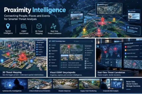
3D Threat Mapping: Turning Complex Data into Visual Context
Traditional maps are useful for understanding where events occur, but they may not communicate every relevant detail. Urban environments, industrial facilities, and large infrastructure networks often contain multiple layers of information that are difficult to represent clearly on a flat map.
3D threat mapping offers another way to explore these environments. By representing buildings, terrain, infrastructure, and selected intelligence indicators in three dimensions, visualization platforms can help analysts understand spatial relationships more intuitively.
For instance, a security team assessing a large industrial facility might combine a three-dimensional site model with publicly available infrastructure information and verified incident reports. The resulting view could help the team understand the surrounding environment, identify areas requiring further assessment, and communicate findings to decision-makers.
In digital investigations, three-dimensional visualization can also complement network topology diagrams and geographic intelligence. Analysts may compare physical locations with network assets or visualize how different infrastructure components relate to one another.
However, a compelling visualization is not necessarily an accurate one. Data sources must be checked for reliability, timestamps must be considered, and uncertain information should be clearly distinguished from confirmed findings. These safeguards help prevent attractive graphics from creating misleading conclusions.
The Rise of the Visual OSINT Encyclopedia
As open-source investigations expand, analysts increasingly need organized ways to store and revisit information. A visual OSINT encyclopedia can address this challenge by bringing together structured records, maps, images, timelines, and links to supporting sources.
Instead of repeatedly searching for the same information, investigators can explore a connected knowledge environment in which relevant entities and events are linked through documented relationships. A location, for example, may connect to public reports, infrastructure records, historical imagery, and related incidents.
This structure can improve collaboration between teams. An analyst reviewing an incident may be able to understand previous findings, examine the evidence behind a claim, and identify unanswered questions without reconstructing the entire investigation from scratch.
Visual knowledge systems can also support training and research. By presenting information in a structured, navigable format, they help users understand complicated subjects while preserving links to original sources.
Nevertheless, an encyclopedia-style system requires careful maintenance. Outdated records, duplicate entries, inaccurate labels, and unsupported associations can weaken the quality of an investigation. Clear sourcing, regular updates, and transparent confidence assessments are essential for keeping intelligence resources useful.
Real-Time Threat Correlation and Faster Decision-Making
Security incidents rarely arrive as a complete, organized set of facts. Information may appear gradually through system alerts, public reporting, threat intelligence feeds, or updates from operational teams. Analysts must determine whether new observations relate to an existing incident or represent an entirely separate development.
Real-time threat correlation helps address this challenge by comparing incoming information with known indicators, historical events, and relevant contextual data. Depending on the platform, this process may incorporate timestamps, geographic coordinates, network indicators, entity relationships, and other structured information.
For example, a cybersecurity team may receive an alert about suspicious network activity while public reporting describes a service disruption affecting the same region. Correlating these observations could justify further investigation, particularly if additional technical evidence supports a possible relationship.
The key is to treat correlation as a starting point rather than proof. Two events occurring at similar times or nearby locations may be coincidental. Analysts must validate the underlying evidence before attributing activity to a specific actor or declaring an incident connected to another event.
When implemented responsibly, correlation systems can reduce manual searching, highlight emerging patterns, and help teams prioritize investigations that require immediate attention.
Practical Applications Across Security and Infrastructure
Spatial intelligence and OSINT techniques have applications beyond traditional cybersecurity operations.
- Critical infrastructure: Organizations can assess publicly documented incidents in relation to facilities, transport networks, and essential services.
- Disaster response: Emergency teams can combine verified reports, geographic information, and infrastructure data to improve situational awareness.
- Supply chain monitoring: Businesses can evaluate reported disruptions across transport routes, logistics hubs, and distribution networks.
- Cybersecurity investigations: Analysts can enrich incident records with geographic context and relationships between relevant infrastructure or publicly documented events.
- Corporate risk analysis: Security and compliance teams can organize credible public information to support risk assessments and informed planning.
These applications require appropriate access controls and respect for privacy. Publicly available information should not automatically be treated as accurate, ethically unrestricted, or suitable for every purpose.
See also: Understanding the Process of Establishing an International Business
Building Trustworthy Spatial Intelligence Workflows
The effectiveness of a spatial intelligence platform depends on more than visualization features. Reliable workflows require accurate data, consistent documentation, and a clear process for validating findings.
Organizations should begin by defining the questions their analysts need to answer. They can then select relevant data sources, standardize location and timestamp formats, and establish procedures for evaluating conflicting reports.
Automation can help identify potential relationships, while human review remains important for interpreting context and assessing uncertainty. Access permissions, data retention policies, and privacy safeguards should also be incorporated into the workflow from the beginning.
Organizations should measure success through practical outcomes, such as reduced time spent gathering evidence, improved source traceability, faster identification of relevant patterns, and more consistent reporting. These indicators provide a stronger basis for evaluating intelligence capabilities than visual complexity alone.
A More Connected Future for Intelligence Analysis
The growing volume of publicly available information makes it increasingly important to connect evidence rather than simply collect it. Proximity Intelligence, 3D threat mapping, visual knowledge systems, and real-time threat correlation offer complementary ways to organize complex information and explore relationships between events.
For cybersecurity teams, infrastructure operators, and OSINT researchers, these capabilities can improve situational awareness and help prioritize investigations. Their effectiveness, however, depends on reliable sources, careful validation, and responsible data handling.
As spatial intelligence continues to develop, organizations that combine advanced visualization with disciplined analytical practices will be better positioned to understand emerging risks and make evidence-based decisions in an increasingly interconnected digital world.